Mountains: Where the Weather Decides for You
The weather changes in thirty minutes, altitude works against you, the terrain is unforgiving: the signs to read before it's too late.
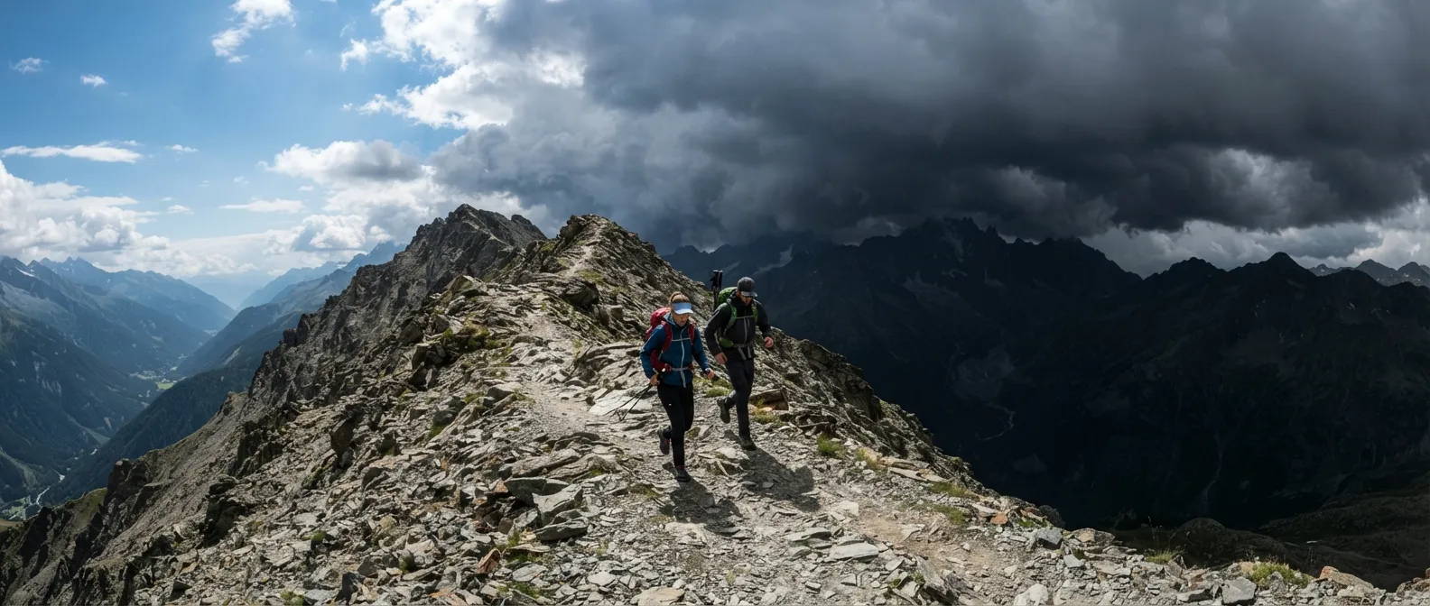
It is past 2 p.m. on the ridge. This morning, the sky was blue and you set off in a t-shirt. Now dark storm clouds are rolling in from the west, your phone has shown zero bars since the last pass, and you have forty minutes of climbing left for twenty minutes of descent to reach a shelter. The mountains don’t give two warnings: they give one sign, and it’s up to you to read it before they decide for you.
What Kills in the Mountains
The numbers don’t lie, even if they’re hard to read. According to high-mountain gendarme data, falls or slips are the number one cause of death, accounting for about half of all cases. In mountaineering, falls cause an average of 24 deaths per year in French massifs; in skiing, the PGHM counts five more every year based on their data alone. On the Mont-Blanc massif alone, the annual toll hovers around 20 to 30 deaths and over a hundred accidents requiring search and rescue interventions — and according to Chamonix gendarmes, over six out of ten serious accidents happen on the descent, when fatigue sets in, crampons get caked with snow, and vigilance drops without you even noticing.
Avalanches are the deadliest natural hazard in France: an average of about 30 deaths per year since 1980, across twenty or so fatal accidents. The 2024-2025 season saw 126 avalanche accidents recorded by ANENA, including 15 fatal ones resulting in 21 victims. And then there’s everything else, less dramatic but just as real: the thunderstorm that strikes a ridge in ten minutes, hypothermia that creeps up without you feeling it, and acute mountain sickness that turns a hike into a medical emergency above 2,500 meters. This module isn’t meant to scare you for the sake of it: it gives you the actions that turn every statistic into a story with a happy ending.
The Weather That Decides for You
In the lowlands, an overcast sky gives you an hour to react. In the mountains, that same sky can turn upside down in thirty minutes, because the terrain does to the weather what it does to everything else: it accelerates it. The ground heats up, air rises along the slopes, cools at altitude, and this mechanical lift — orographic lift — builds clouds faster and stronger than over flat land. A mere 2°C temperature gap between two air masses can be enough to turn a beautiful day into a violent thunderstorm.
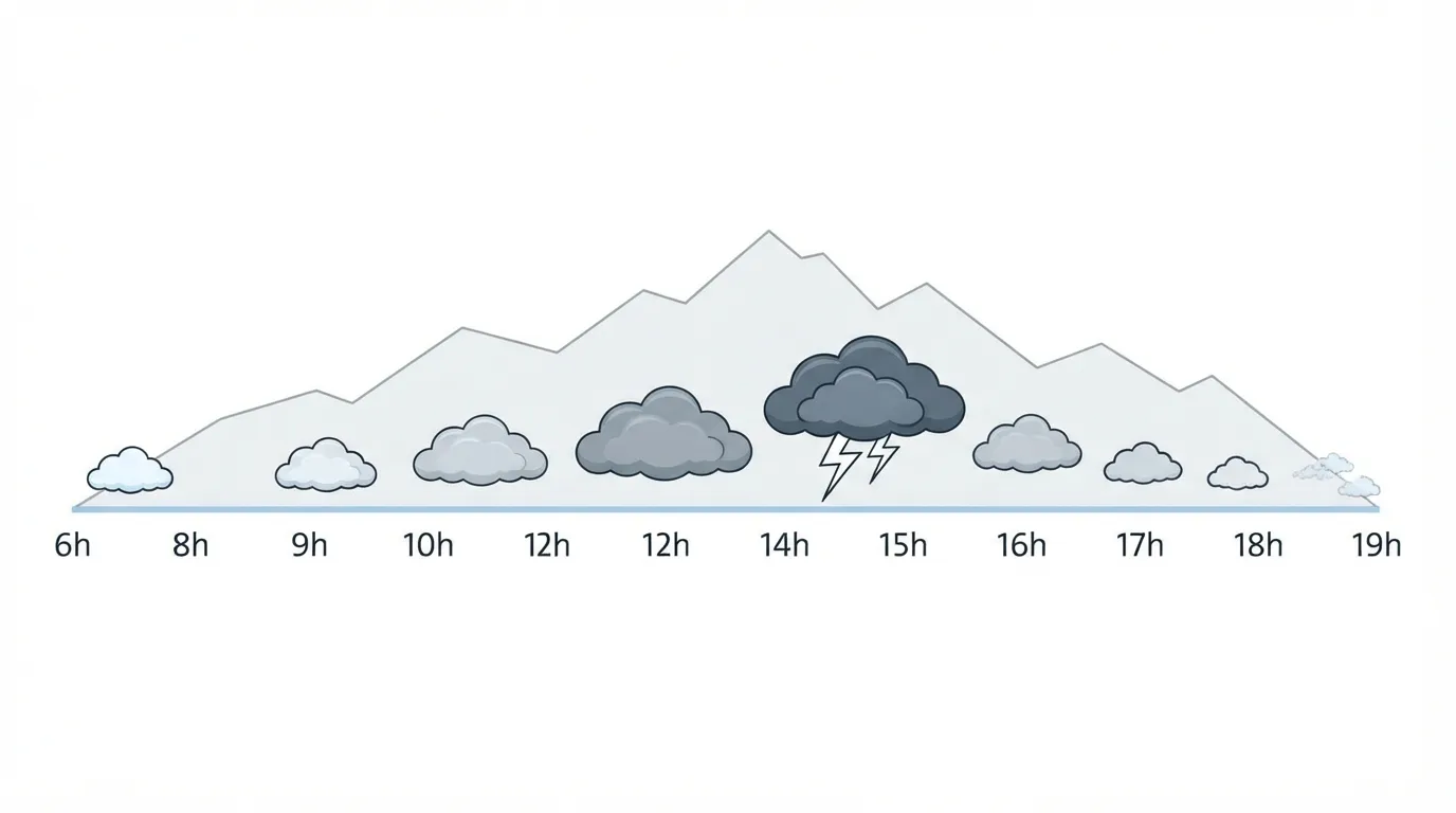
The most useful rule of thumb: in the Alps, the Pyrenees, and the Jura in summer, thunderstorms break systematically between 2 p.m. and 6 p.m., after a morning of solar heating on rocky slopes. The cycle runs almost like clockwork: cumulus clouds build around noon, merge into cumulonimbus around 1–2 p.m., burst in the mid-afternoon, and dissipate around 7 p.m. Setting off late thinking you’ll “save time” is one of the most common summer mistakes — that is precisely when the sky turns on you.
The most reliable sign to estimate the distance of a thunderstorm: count the seconds between the lightning flash and the thunder clap, divide by three, and you get the distance in kilometers. Under 30 seconds apart, the storm is less than 10 km away and the danger is real.
Fog and Whiteout
Fog is navigation’s number one enemy in the mountains: it gives very little warning before swallowing every visual landmark—ridge, valley, trail. The best practice is to take bearings toward the valley before visibility closes in — a compass heading measured in advance is far better than improvising in the grey. Break down the route into short segments between identifiable points, and mentally map out a retreat route. In winter, fog comes with the added risk of a “whiteout”: snow and sky merge into a single shade of white, the horizon disappears, and vertigo sets in even on flat terrain.
Cold That Comes Without Warning
Wind doesn’t lower the thermometer, but it accelerates the rate at which your body loses heat: this is wind chill. In practical terms, at -5°C with a moderate wind of 30 km/h, your body experiences the same stress as if it were -12°C with no wind. Past a wind chill index of -27, the risk of frostbite becomes real: exposed skin can freeze in under 30 minutes. In the mountains, where the wind almost always blows harder than in the lowlands, this gap between displayed temperature and perceived temperature is often what catches people off guard the most.
Hypothermia sets in through stages you don’t notice yourself: feeling cold, shivering, blue lips, followed by fatigue and muscle stiffness — at this stage, the person is already in danger. The skin turns pale and waxy, and movements lose coordination. As soon as altered consciousness appears, it is a life-threatening emergency.
Altitude, the Unseen Enemy
Above 2,500–3,000 meters, your body lacks oxygen faster than it can adapt, and acute mountain sickness (AMS) usually sets in between 4 and 12 hours after arrival: headache, nausea, insomnia, general fatigue, dizziness, shortness of breath, loss of appetite. It recedes with acclimatization or disappears quickly upon descending — but it cannot be cured by pushing forward faster.
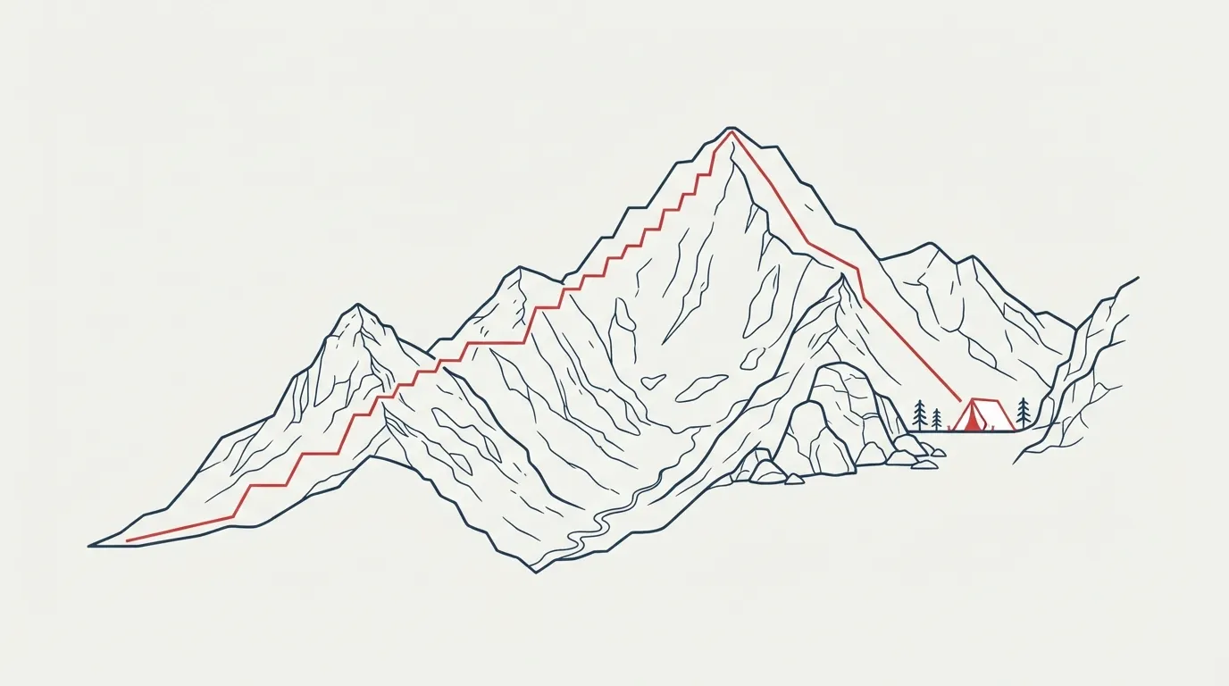
The rule that works is “climb high, sleep low”: you can climb higher during the day, to cross a pass for instance, provided you descend to sleep lower down. In practice, do not gain more than 300 to 500 meters of sleeping altitude per night above a certain threshold, or stay two nights in the same spot if the day’s progression exceeds 600 to 900 meters — and never add more than 300 meters of sleeping elevation above 3,700 meters.
Two rare but fatal complications lurk behind ignored AMS: high-altitude pulmonary edema (HAPE) and high-altitude cerebral edema (HACE). HAPE presents as worsening shortness of breath, a dry cough that becomes productive and sometimes bloody, cyanosis, and severe fatigue. Without treatment, coma and death can occur within hours. The primary treatment is emergency descent, supplemented with oxygen if available.
For moderate to high-risk stays, acetazolamide (Diamox) remains the only medication with proven preventive effectiveness: start taking it 24 hours before crossing the 2,500-meter threshold, and stop upon descent or after two days at the highest point.
Lightning: The Position That Saves Lives
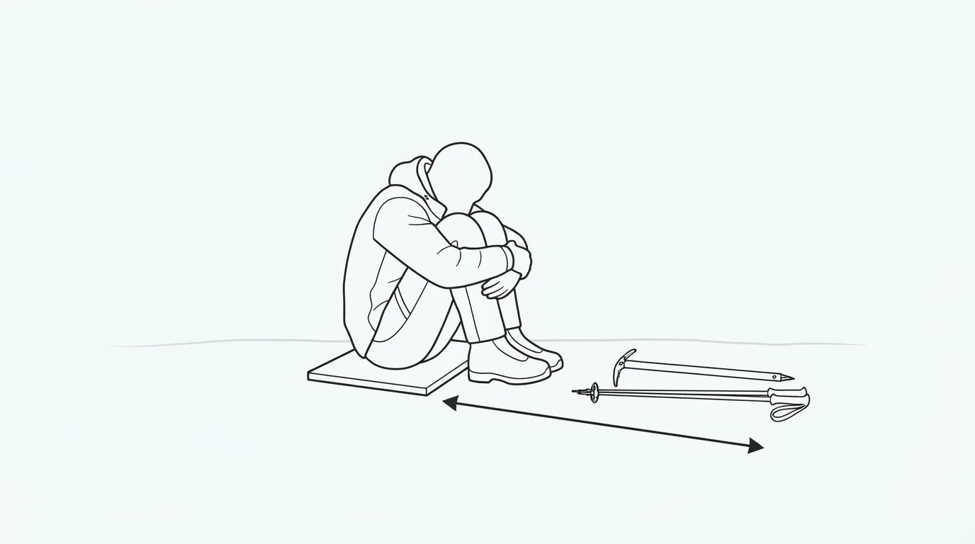
A peak only needs to be about 4 meters high to become “effective” as a lightning attraction point — which means any ridge, isolated tree, or pole in your path is one. And the main danger is often not a direct strike: ground currents, which spread laterally from an impact point, strike far more often than lightning itself. Hence the safety distance of at least 10 meters between people while waiting, and 30 meters for any metallic gear — ice axe, trekking poles — laid flat on the ground, never held or stuck upright.
In an emergency position: crouch down, feet together to reduce ground contact, arms wrapped around your knees, head tucked in, on an insulating pad if possible. Counter-intuitive but real: rock crevices, cave entrances, and water runoffs also conduct ground currents, making them poor shelters despite looking protective. Between open flat ground and a dense, uniform forest, the forest is the safer choice — provided you stay away from the tallest trees.
For step-by-step details on what to do if a thunderstorm hits while you’re outdoors, the dedicated guide on thunderstorms covers every action in real time. For now, remember the essentials: distance, posture, and gear flat on the ground.
Terrain That Betrays
Scree Slopes and Talus
A falling rock can be triggered by rain, freeze-thaw cycles, melting snow, vegetation growing in a crevice, seismic tremors — or simply a hiker or chamois passing above you. Statistically, you are far more likely to fall yourself due to inattention than to be hit by a falling rock. But in exposed areas — chutes, beneath rock faces — the rule is simple: never stop, cross quickly with your head up, and a helmet is justified as soon as the terrain calls for it.
Snowfields and Ice Axe Self-Arrest
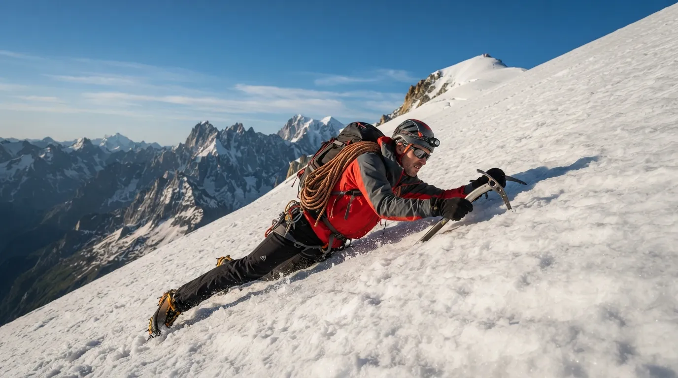
Even in midsummer, an early morning snowfield is an ice rink: overnight freezing hardens the snow before the sun softens it during the day. On this slope, only an ice axe can stop a slide — trekking poles won’t cut it. The self-arrest technique boils down to this: if you slip, flip onto your stomach, head uphill, and drive the pick of the ice axe into the snow at shoulder level, leaning on it with your body weight; if wearing crampons, lift your feet to prevent them from catching and causing your body to flip uncontrollably. This technique requires real practice. Without it, the only reasonable choice when facing a steep snowfield is to turn back and find another way.
Crossing a Torrent
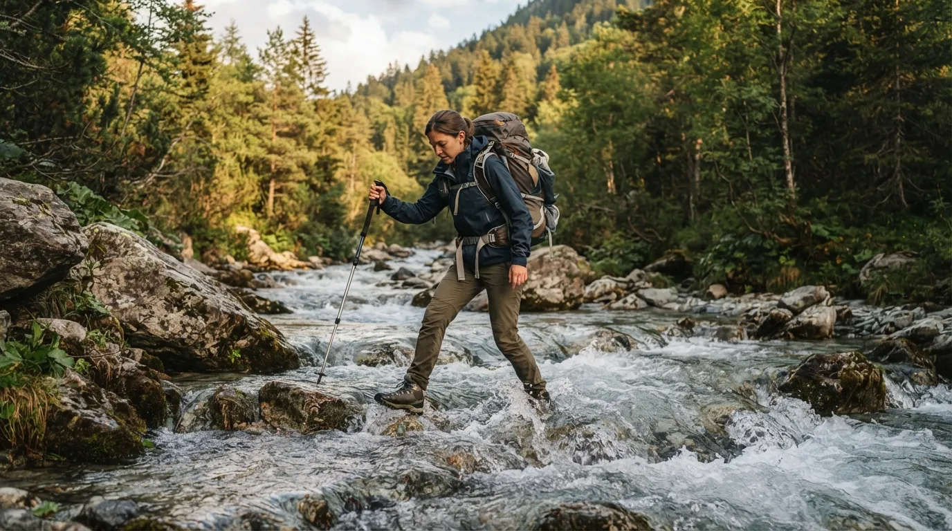
A mountain stream’s flow can surge rapidly after an upstream thunderstorm — sometimes in just twenty minutes — long before rain reaches your location. If the visible current exceeds 1.5 m/s (whitewater around obstacles), do not attempt to cross with a pack on your back; in water below 5°C, this threshold drops to 1 m/s due to the risk of muscle cramps in a fall.
- Unbuckle your pack’s hip belt and chest strap completely: in a fall, you must be able to shed it in under two seconds.
- Choose a wide, shallow section rather than a narrow channel, avoiding outer bends where water carves deeper and flows faster.
- Place your trekking pole or a sturdy branch on the upstream side: combined with your two legs, it forms a stable tripod.
- Move diagonally at a 45-degree angle with the current, never perpendicular to the bank.
- Always move the pole first, then one foot, then the other — never move two points of contact at once.
- In groups of three or more, form a human chain facing upstream, hands on the shoulders of the person in front, with the heaviest person leading at the front.
Crevasses
On a snow-covered glacier — the most common scenario, even in summer — traveling roped up is essential, except on bare ice where crevasses remain visible. The rope must stay taut at all times to catch a fall instantly, with 10 to 15 meters of spacing between team members, using a dynamic rope rather than a static one to better absorb the impact of a fall. This is not a skill to improvise solo by reading an article: practice it with a professional before stepping onto a glacier.
Simple Habits That Cost Nothing
Most preventable accidents are resolved before even stepping foot on the trail, through level-headed decisions made beforehand rather than under fatigue and summit fever. A simple guideline: if you’ve used up half your planned time but covered only a third of the distance, that’s your signal to turn around.
Some groups go a step further by setting a turnaround time: a pre-determined time or location set before leaving, past which you automatically turn back without debate — precisely so this decision isn’t made too late under the influence of exhaustion or group enthusiasm.
Taking Shelter When the Mountain Closes In
Unstaffed Huts
Outside the guarded season, most alpine club huts keep an accessible, open section to fulfill their role as emergency shelters. But self-sufficiency remains the rule: no staff, no meal service, and available supplies — mattresses, blankets, firewood — vary wildly from hut to hut. The rules of good conduct are simple and carry heavy consequences if ignored: use firewood sparingly (the next resupply won’t arrive until next season), never force a locked door, step far away from the hut for bathroom needs, and above all close the entrance door securely — a door left open can severely damage a shelter within days of bad weather.
Rock Overhangs, Snow Holes
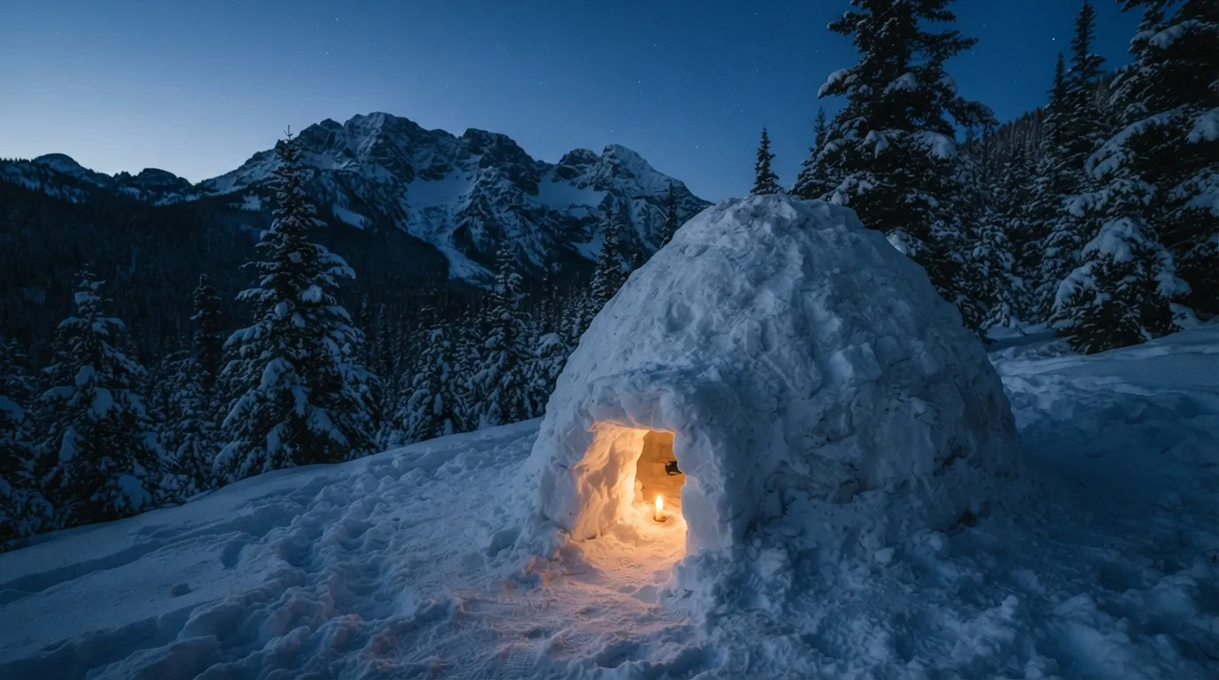
A rock overhang facing away from the prevailing wind is the fastest natural shelter to find in the mountains. On snow, two techniques stand out: the snow cave, dug directly into an existing natural drift, and the quinzhee — a word of Athabaskan origin —, a shelter dug into a mound of snow you pile up yourself. Pack the snow into a dome, stick 30 cm bare sticks all around it to gauge wall thickness while digging, and let it sinter for at least three hours before excavating from the inside: this hardening time is what makes the structure solid.
Water That Only Looks Clean
The turquoise water of a glacial stream is deceptive: that color comes from “rock flour,” extremely fine mineral particles ground down by bedrock erosion beneath the glacier and suspended in the water — the famous “glacier milk.” This water isn’t dirty in the usual sense, but it’s loaded with sediment that clogs filters and complicates purification, and it can also contain atmospheric pollutants trapped in the ice for decades and released upon melting. Whenever possible, look for a fresh spring flowing straight out of rock, or a clear tributary rather than the main stream heavy with glacial flour.
Signaling for Help in the Mountains
The international distress protocol comes down to two numbers: six signals per minute — sound, light, or visual gestures — repeated after a one-minute pause, mean “I need help.” In response, three signals per minute mean “message received.” A pea-less whistle (the kind used by rescuers) keeps working when wet or in freezing cold, whereas a traditional pea whistle can jam. A signal mirror — or failing that, a phone screen — produces flashes visible for tens of kilometers on a clear day.
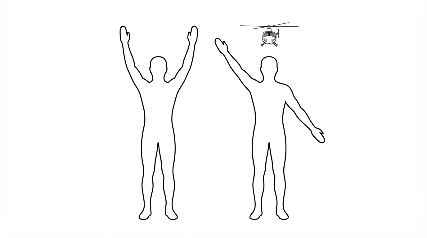
When facing a rescue helicopter, two gestures are all you need: raising both arms in a Y shape means “yes, I need help”; one arm raised and the other pointing down diagonally means “no, everything is fine.” You must stand completely still while signaling — that is precisely what distinguishes a distress call from a hiker simply waving hello to the crew —, and stand with your back to the wind, as the pilot needs to judge wind direction to land without having to guess it from the air.
As for phones, 112 works without an active plan and sometimes even without a SIM card inserted, by automatically hopping onto another operator’s network in the area — including cross-border Swiss or Italian networks. With no cellular coverage at all, several modern smartphones now feature satellite SOS capabilities: simply point the device toward an open sky. For more remote expeditions, a satellite beacon like COSPAS-SARSAT (no subscription, battery replacement every 5 to 7 years) or a two-way device like Iridium (requires a plan, SMS capped at 160 characters) remain the most reliable options — note that certain countries, including China, Iran, or North Korea, restrict their use, which is worth checking before traveling abroad.
Unplanned Nights: The Forced Bivouac
A wrong turn, a sudden weather shift, an injury that slows the pace: an unexpected night out in the mountains happens more often than you think, and it is far more manageable than you might fear.
- Breathe and stay calm: stress leads to hasty decisions — rushing through the dark on unfamiliar terrain is often far more dangerous than spending the night outside.
- Choose a shelter out of the wind, but not too close to a water source — animals come to drink at night — nor in a depression where cold air pools.
- Preserve your body heat above all: isolate yourself from the ground using whatever you have, slide an emergency blanket under your seat, keep dry clothing close to your body.
- Signal if you are in actual danger: three short whistle blasts, three fires arranged in a triangle if you can safely build them.
- Wait for daylight before moving across terrain you don’t know well.
The Day Hike Essentials Pack
Encounters on the Trail: Livestock Guardian Dogs and Vipers
Livestock Guardian Dogs (Patous)
A patou isn’t trained to attack: its role is deterrence, protecting the herd it grew up with and considers its pack. It detects an “intruder” from several hundred meters away, barks first to raise the alarm, and may approach to catch your scent. Behavioral studies show low overall aggression toward solo hikers — most incidents are triggered by the hiker’s own behavior, especially when accompanied by an unleashed dog, which the patou can perceive as a predatory threat to the herd.
Vipers
A viper bite is identified by two puncture marks 5 to 8 mm apart from the fangs. About half of all bites inject no venom at all, and only about 20% deliver a full dose — which still means you should call for emergency services immediately upon suspecting a bite, without waiting for symptoms to appear.
Frequently asked questions
How long can weather forecasts stay reliable in the mountains?
Much less time than in the lowlands: a clear blue morning sky can turn into a thunderstorm within thirty minutes, especially in summer between 2 p.m. and 6 p.m. The safest approach is to plan your descent before early afternoon and keep an eye on cumulus clouds building from midday onward.
What should I do if I hear a buzzing sound or feel my hair stand on end before a storm?
This indicates an imminent electrical discharge, potentially within seconds. Assume the safety position immediately: crouch down, feet together, well away from ridges, isolated trees, or metallic gear held in your hands.
Can you drink water from a mountain stream without treating it?
It is not recommended, even if it looks crystal clear. Glacial water contains fine rock particles in suspension and sometimes sediment trapped in the ice for decades. It’s better to look for a spring flowing directly out of rock or treat the water before drinking.
How do you spot acute mountain sickness?
Headache, nausea, insomnia, unusual fatigue, and dizziness appearing between 4 and 12 hours after reaching altitude, typically above 2,500–3,000 meters. The only reliable cure is to descend; ignoring these signs and pushing higher is what turns manageable AMS into a life-threatening emergency.
What should I do if I encounter a livestock guardian dog while hiking?
Stop, turn sideways so you aren’t facing it head-on, and walk away calmly while giving the livestock a wide berth. Do not run, do not try to pet it, and put your own dog on a leash before coming into sight of the herd.
How can I call for help if my phone has no service?
Dialing 112 can sometimes route through another operator’s network available in the area, even without an active plan. With no cellular coverage whatsoever, some recent smartphones offer satellite SOS by pointing the phone toward an open sky; for truly remote areas, a dedicated satellite beacon remains the most reliable option.
Key Takeaways
- Mountain weather changes in half an hour: monitor the sky starting at midday and schedule your descent before 2 p.m. in summer.
- For acute mountain sickness, there is only one true cure: descend. No medication replaces dropping elevation.
- In a thunderstorm: keep your distance, crouch with feet together, and lay metal gear flat on the ground away from you.
- Stream crossings, snowfields, and scree slopes require specific techniques — never cross in a rush or without assessing the risk.
- Telling someone your route and expected return time remains the fastest trigger for emergency services, even before dialing 112.
Going Further
- UIAA Medical Commission, Consensus statement on AMS, HAPE and HACE — the international medical benchmark on altitude sickness.
- Swiss Alpine Club (SAC), Passages dangereux et comportement adéquat — rockfall, snowfields, torrents, all in one guide.
- ANENA, 50 ans d’accidents d’avalanche en France — comprehensive accident data, season by season.
- FFCAM, Refuges et chalets non gardés, mode d’emploi — knowing what to expect before spending a night in an unstaffed hut.
Sources for this module (18)
- ANENA — 50 ans d'accidents d'avalanche en France (Neige & Avalanches n°173)
- ANENA — Données d'accidents d'avalanche en France, archives et bilan 2024-2025
- Ascension Mont-Blanc — Sécurité, risques et statistiques PGHM
- FFME — Le mal aigu des montagnes
- UIAA Medical Commission — Consensus statement on AMS, HAPE and HACE
- Club Alpin Suisse (CAS) — Passages dangereux et comportement adéquat
- letsgoplayoutside.com — Traverser un cours d'eau en randonnée, 9 règles de survie
- Ortovox Safety Academy Lab Rock — Hypothermie et morsure de serpent en terrain alpin
- FFRandonnée — Que faire en cas de morsure de vipère ?
- Yaute Rando — Les signaux de détresse universels en montagne
- Sentier Nature — Alerter les secours en montagne, du 112 aux systèmes satellitaires
- PisteHors — Rechercher une victime d'avalanche avec l'ARVA
- FFCAM — Refuges et chalets non gardés, mode d'emploi
- Haute-Savoie (services de l'État) — Chiens de protection des troupeaux (patou)
- Summit Day — L'orage en montagne, terreur des alpinistes
- Wikipédia — Quinzhee
- Camptocamp — Forum, orage en résumé
- MétéoSuisse — Refroidissement éolien (wind chill)
Continue in "By environment"
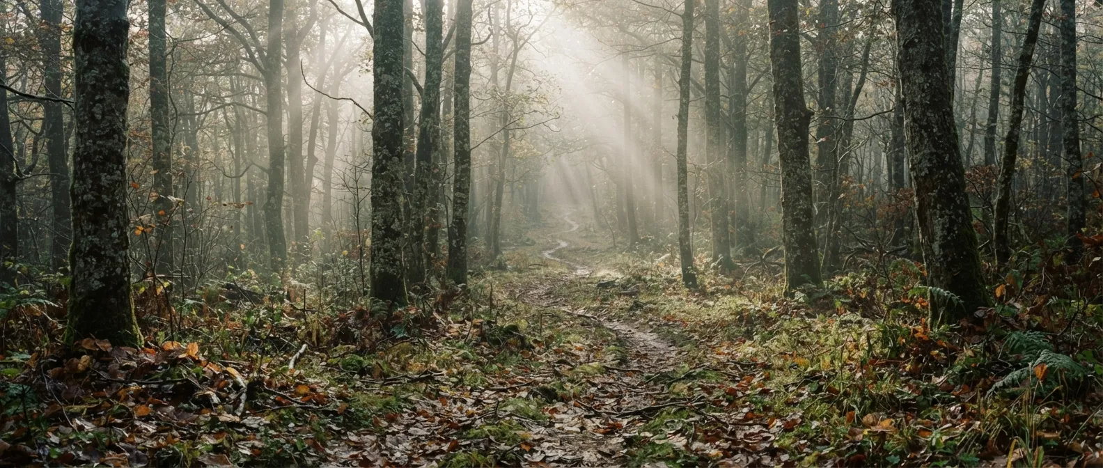
The temperate forest
The most generous environment in the world can also swallow you in ten minutes: here is how to read it instead of fearing it.
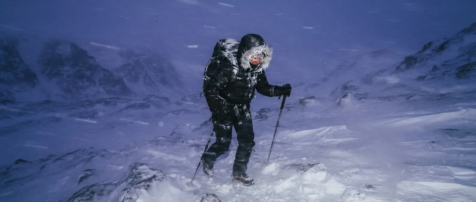
Snow, extreme cold, and the Far North: surviving at minus 30
Cold doesn't kill you: humidity, exhaustion, and panic do. What you need to know to stay alive below zero.
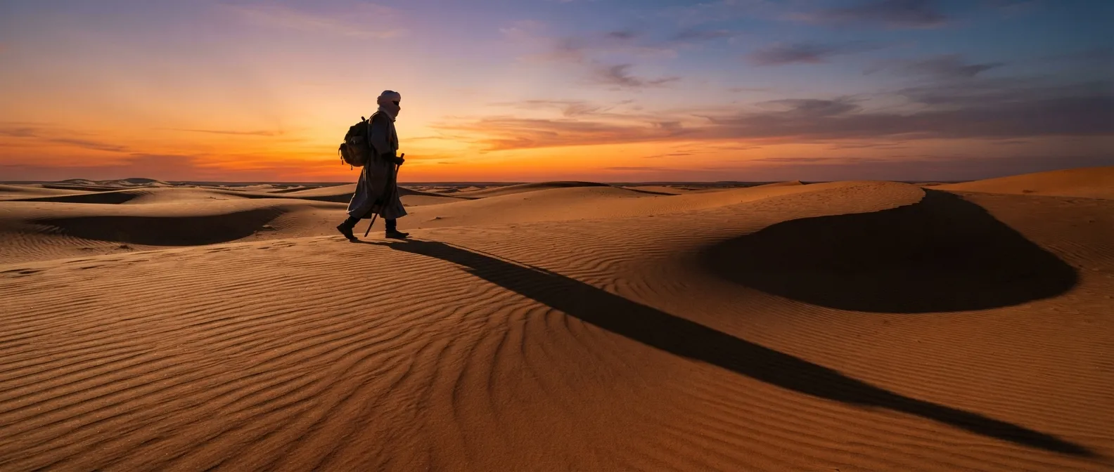
Desert: water, shade, and keeping still during the day
It isn't 45 °C because there's no shade: it's 45 °C, and on top of that, there's no shade. The difference is paid in liters.