The Coastline: The Shore, a Pantry That Rises and Falls
Twice a day the sea retreats and serves you a free buffet; twice a day it returns, faster than a galloping horse, waiting for no one.
It’s 3 p.m., you’re walking on the sand uncovered by low tide, mussels stretch as far as the eye can see, and you figure you’ll never starve here. It’s 5:30 p.m., you look behind you: the strip of water that ran along the rock has joined the one that ran along the dune, and the path you took on the way out is now a deep channel. The coast is the most generous environment in all of wilderness survival — and the only one that takes back what it gives, twice a day, almost on the dot.
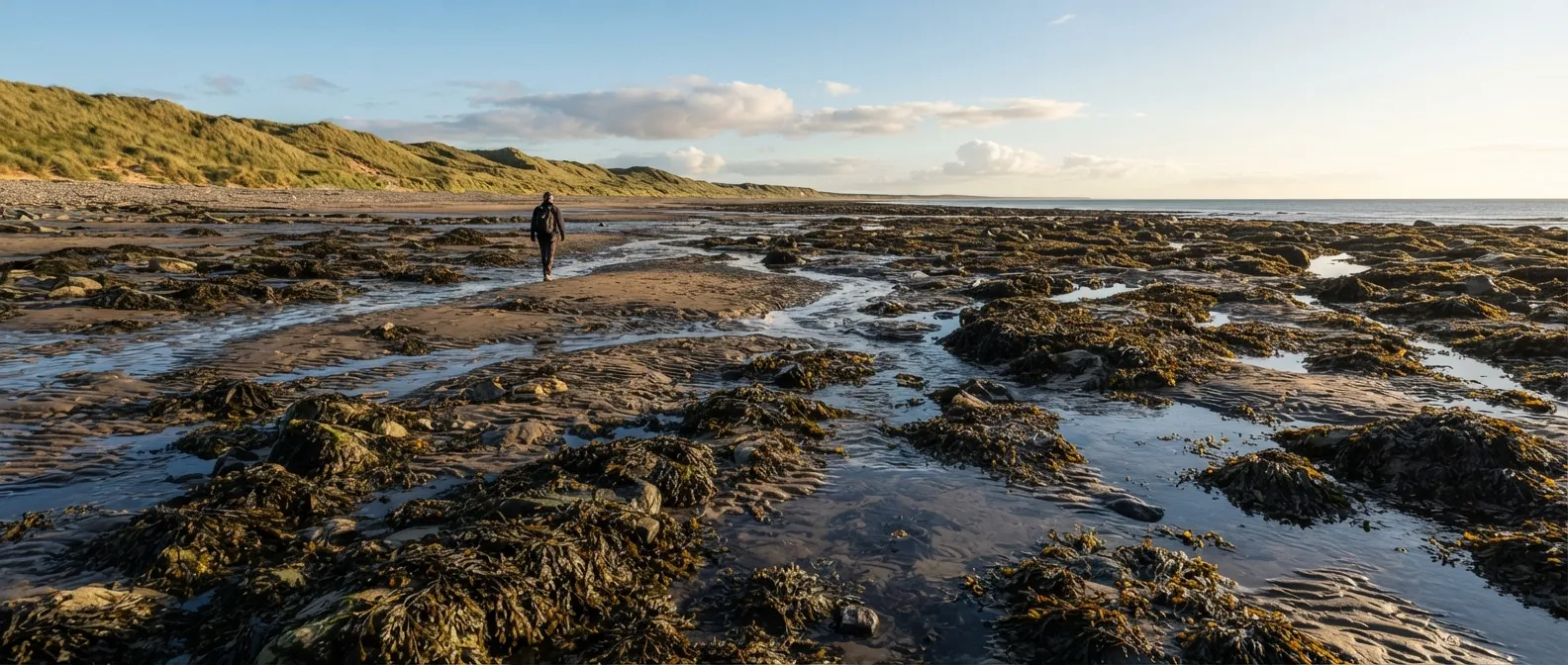
Why the coast is the best place to avoid starving
No other environment reloads its food supply so fast, so visibly, and without needing to hunt for it. At every low tide, the intertidal zone — the strip of land uncovered and then covered by the sea — exposes shellfish clamped to rocks, crabs tucked under stones, seaweed that regrows in a few weeks, and residual tide pools full of trapped little fish. It’s a self-regenerating resource, unlike game that gets overhunted or wild plants that eventually run dry.
The coast also offers something no forest ever gives: clear landmarks. A straight line that you can never lose (the shoreline), an axis you’ll never confuse with anything else, and the certainty that following the water will sooner or later lead you to a harbor, a village, or a road. Statistically, it’s also the first place search parties look for a castaway or a lost hiker: boats, planes, and strollers stick to the coastlines rather than wandering at random into deep woods.
And under the sand that looks completely barren, behind the dune that everyone ignores, there is often fresh water — a detail that the vast majority of fictional castaways (and quite a few real ones) miss by digging in the wrong direction.
What actually kills you on the coast
Danger here almost never looks dangerous. It’s a flat beach, turquoise calm water, a friendly rock for foraging. The list of things that truly kill on a coastline has almost nothing to do with sharks.
The tide that climbs faster than you can walk
In Mont-Saint-Michel Bay, the tidal range — the height difference between low tide and high tide — reaches 15 meters, one of the highest in the world. A local saying claims the sea comes in “at the speed of a galloping horse”: that’s not just a poetic image. On a near-flat tidal flat, a sheet of water advancing several kilometers in a few hours gains horizontal speed for every inch it rises vertically. The problem is never the depth right where you’re standing: it’s the channel filling up behind you, between you and dry land, while you’re looking forward.
Quicksand and mudflats
Contrary to what movies show, you never sink completely into quicksand: the mix of fine sand, water, and salt has a density close to 2, nearly double that of the human body, creating buoyant forces that halt sinking around the thighs. The Bayeux Tapestry already depicts soldiers trapped in the quicksand of that very same bay. The real danger isn’t disappearing underground: it’s staying stuck while the tide keeps rising around you.
Quicksand exhibits thixotropic behavior: it acts solid at rest and liquefies the moment you agitate it. Thrashing around buries you deeper; staying calm and slowly spreading your legs out flat, distributing your weight to lie on your belly as if crawling, lets you pull yourself out slowly — the viscosity increases over time when undisturbed until the sand becomes firm enough to support you again.
Baïnes and rip currents: when the water turns on you
A baïne (a Gascon word for “small pool”) is a trough dug into the sand by ocean swells in the surf zone — up to 100 meters wide and 4 to 5 meters deep on Atlantic beaches. While the tide falls, a baïne acts like a calm, warm swimming pool, making it popular with families. The trap springs when the tide rises and submerges the sandbar enclosing the pool: accumulated water suddenly flushes back out toward the open sea, generating currents exceeding 2.5 m/s — faster than any human can swim.
- Never fight it head-on. Swimming against a 2.5 m/s current is physically impossible, even for elite athletes: panic and exhaustion cause drowning, not the current itself.
- Swim parallel to the shore for a few dozen meters until you escape the narrow neck of the current — visible from the beach as a darker or discolored, flat strip of water cutting through breaking waves.
- Once clear of the current, head back to the beach at an angle, letting normal waves push you in.
- If you can’t swim or tire out, float on your back and let the current carry you beyond the breaker zone: it always weakens eventually, and rescuers or onlookers can spot a calm, floating swimmer far offshore much easier than someone struggling in the white water.
Collapsing cliffs
A cliff isn’t a solid wall: it’s a pile of rock in slow motion, falling at a pace dictated by its geology. Chalk cliffs in Normandy retreat about 20 cm per year on average; locally in northern France, coastal erosion can reach up to 5 meters per year. The base of a cliff, an overhang that feels like a sheltered roof, and the edge of the cliff top within a meter of the drop are statistically the most dangerous places on the coast — far more so than a quick dip in the sea.
Rogue waves, sneaker waves, and cold shock response
By scientific definition, a rogue wave is any wave whose height exceeds twice the significant wave height of surrounding sea conditions: the famous Draupner wave, measured in the North Sea in 1995, reached 25.6 meters. On rocky shores, their smaller and much more frequent cousin is the sneaker wave: a single wave two to three times larger than the preceding set, capable of surging up to 50 meters past the normal foam line, sweeping off unsuspecting walkers or foragers. On the Pacific coast of North America, sneaker waves claim more lives than all other weather-related coastal hazards combined.
If you get swept away, the real clock starts upon immersion: in water below 15 °C (59 °F), your ability to hold your breath drops from 60–90 seconds down to just a few seconds. This is the cold shock response, the body’s immediate reaction to sudden cold water immersion, forcing an involuntary gasp at the worst possible moment. It’s this reflex gasp — not hypothermia itself — that causes most drownings within the first few minutes.
| Baïne / Rip current | Quicksand | Rising tide | |
|---|---|---|---|
| Danger speed | Seconds, without warning | Slow, time to react | Progressive but relentless |
| Lifesaving response | Swim parallel to shore | Stay calm, lie flat, crawl | Leave before the water starts coming in |
| Fatal mistake | Swimming head-on against current | Thrashing around, sinking deeper | Underestimating speed on flat terrain |
Reading the tide without a watch or schedule
No tide chart, no cell service: the beach itself tells you the time, as long as you know how to read it.
- The wrack line (or seaweed line): the band of debris — seaweed, driftwood, shells — deposited by the previous high tide at its highest reach, running parallel to the shore. It shows you precisely where the water went last time. If you’re camping, never pitch your shelter between the wrack line and the water: the next high tide will reach at least that mark, and higher if the tide is rising.
- Tidal range and coefficients: tidal amplitudes vary greatly based on lunar alignment. When the tide is building toward a spring tide (around full or new moons), high tides run higher and low tides drop lower. A high range means water moves in much faster than average.
- The rule of twelfths: over the 6 hours separating low tide from high tide, the water doesn’t rise at a constant rate. It gains roughly 1/12 of the total height change during the 1st hour, 2/12 in the 2nd hour, 3/12 in the 3rd, 3/12 in the 4th, 2/12 in the 5th, and 1/12 in the 6th hour. In short: it starts slow, speeds up dramatically in the middle (hours 3 and 4 swallow half the total tidal height), then slows down again. This mid-tide surge catches people off guard: you think you have plenty of time, then the water suddenly doubles its speed.
- The Moon: during a full moon and new moon, the Sun and Moon pull in alignment, producing the strongest tides (spring tides). At half moons (quarter phases), their gravitational pulls partially offset each other, causing weaker tides (neap tides). Glancing at the Moon at night gives you a reliable indicator of tidal amplitudes over the coming days.
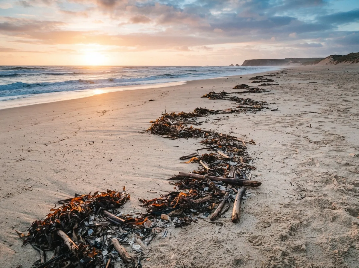
The pantry revealed twice a day
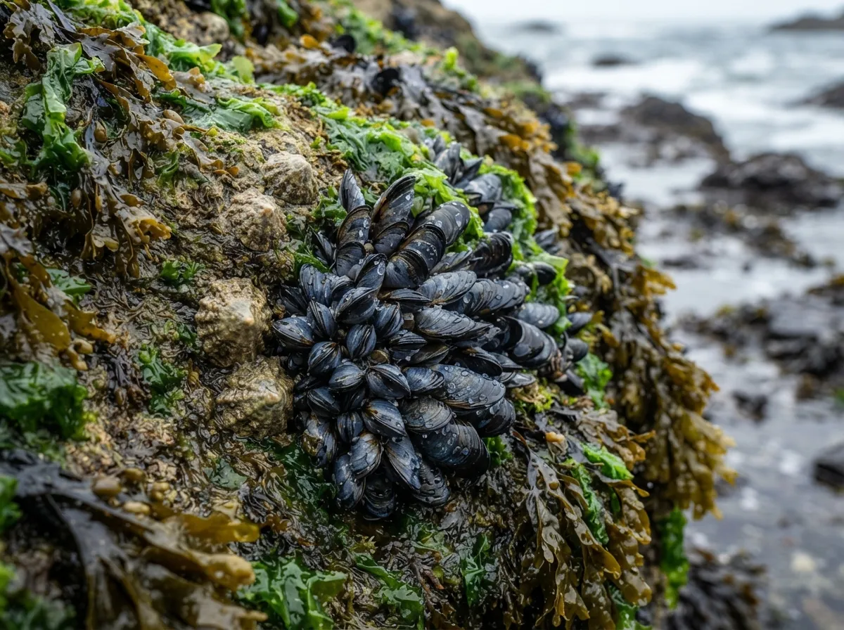
Shellfish: protein that can’t run away
- Mussels (Mytilus edulis): attached in clusters to rocks by strong threads (the byssus), fully visible at low tide. They filter seawater continuously, making them great indicators of water quality — but a bad choice near sewer outlets or busy harbors: always assess surrounding water quality before harvesting.
- Limpets (Patella), those small conical shells clamped to rocks: strike them with a sharp, sideways tap using the flat edge of a knife blade, never by pulling straight out. This pops them off before their muscular foot clamps down — once alerted to danger, their suction power can break the shell before letting go.
- Periwinkles: small sea snails gathered easily by hand in tide pools and under seaweed mats. They can be boiled directly in seawater and extracted with a pin or thorn — a long-standing tradition across coastal Atlantic regions.
- Razor clams: long, razor-shaped bivalves living vertically buried in wet sand. Look for small, keyhole-shaped or “8-shaped” holes on the surface where they breathe at low tide. Pouring a pinch of salt directly into the hole tricks the clam into thinking the tide has returned, causing it to pop up a few centimeters — just enough to grab firmly before it retreats faster than you can dig.
- Clams and cockles: buried deeper in the sand, harvested by digging with a fork or rake in wet, grainy sand; walking over them often reveals their location through tiny jets of water squirting up.
Crabs: hunting by torchlight or turning stones
Ghost crabs (Ocypode) and most small shore crabs are primarily nocturnal, staying hidden in deep burrows during the hottest or coldest hours of the day. Twilight or night foraging with a headlamp set at eye level (to catch the glint off their eyes) is the easiest way to catch them out in the open. During daylight low tides, search beneath flat stones near the tide line: flip rocks over, grab crabs from behind the carapace to avoid the claws, and always return the stone to its original position — it serves as shelter for dozens of other organisms.
Seaweed: almost everything is edible
Here’s a surprising fact about the coast: unlike mushrooms or berries, there are no deadly poisonous seaweeds in temperate ocean waters. The danger almost exclusively comes from chemical or bacterial pollution in the water where they grow, not from the algae itself.
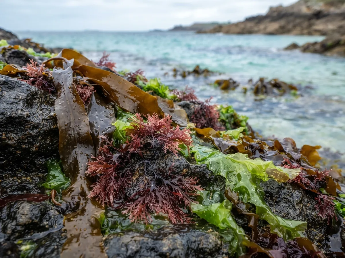
- Sea lettuce (Ulva lactuca), thin and bright green, eaten raw or cooked; historically relied upon as a famine food during lean periods along European coasts.
- Dulse (Palmaria palmata), deep red to purplish, traditionally harvested by hand at low tide from summer to autumn. Sun-dried, it makes a salty, crisp snack — Pacific varieties, when pan-fried, are even noted for having a bacon-like flavor.
- Kombu (kelp), a thick brown kelp growing in long ribbons, rich in natural iodine. Used since the Middle Ages to treat goiters (iodine deficiency); consume in moderation, as extreme iodine intake can disturb thyroid function.
- Wild nori (Porphyra), gathered off coastal rocks, tougher in texture than processed sheet nori used in sushi rolls.
Sea urchins
Edible sea urchins are gathered in shallow water between rocks at low tide. Split them open by cutting around the soft mouth area on the flat underside with a knife or cracking the shell open with a stone. Inside, you’ll find five orange, star-shaped gonads (often called “roe”) that are eaten raw right out of the shell. Watch out for species like Diadema or the venomous flower urchin found in tropical waters, which sport sharp or venomous spines that inflict severe pain: in unfamiliar waters, handle them with thick gloves or a heavy cloth.
Tidal fish traps
Thousands of years ago, Indigenous coastal cultures across the globe developed a brilliantly simple trap: a crescent-shaped wall built of stone or wooden stakes, with the open curve facing seaward. As high tide comes in, fish swim over or into the wall; as the tide retreats, the wall traps them inside shallow pools. Some of these stone structures have stood for millennia: the Budj Bim eel traps in Australia are dated back at least 6,600 years, making them among the oldest aquaculture systems in the world. Hundreds of ancient stone tidal traps survive on Taiwan’s Penghu Islands as well. You can easily replicate this design using beach materials: build a stacked-stone arc high enough to clear low-water levels across a natural channel that fills and drains twice daily.
Seabirds and eggs
Seabird colonies nest along coastal cliffs and offshore islets, and their eggs historically sustained long-distance mariners: in the 19th century, commercial eggers harvested nearly half a million eggs a year from the Farallon Islands off San Francisco. This is also a textbook example of what not to do: that level of commercial exploitation took decades to repair, and some bird populations never fully recovered. In a genuine survival scenario, taking an egg or two from a large, active colony without depleting individual nests is a reasonable supplement; raiding an entire colony never is.
Marine toxins: what can actually kill you in this pantry
The single biggest hazard in coastal foraging is completely invisible: toxic microalgae blooms (“red tides”) release powerful neurotoxins (such as saxitoxin) that filter-feeding shellfish — mussels, clams, cockles — accumulate without being harmed themselves. In humans, consuming contaminated shellfish causes Paralytic Shellfish Poisoning (PSP), with symptoms starting in 10 to 30 minutes: tingling around the lips and face, rapidly progressing in severe cases to respiratory paralysis.
Fresh water hidden in plain sight
The coastal paradox: you can die of thirst surrounded by an endless ocean of water. Yet fresh water is often much closer than it seems.
On a sandy beach or barrier island, rainwater soaking into the ground forms a freshwater lens: a convex layer of fresh groundwater floating directly on top of denser saltwater beneath the surface. This hydrologic phenomenon is documented across coastal zones worldwide — during the 1997–1998 drought on the Marshall Islands, monitoring wells saw freshwater lenses thin down to 5.5 meters before recovering several meters following heavy rains. To reach it: dig a hole behind the primary sand dune, never on the open beach where seawater infiltrates directly. The water seeping into the bottom of the pit will start out murky, but settles clear after a few minutes — test a tiny drop on your lips before drinking.
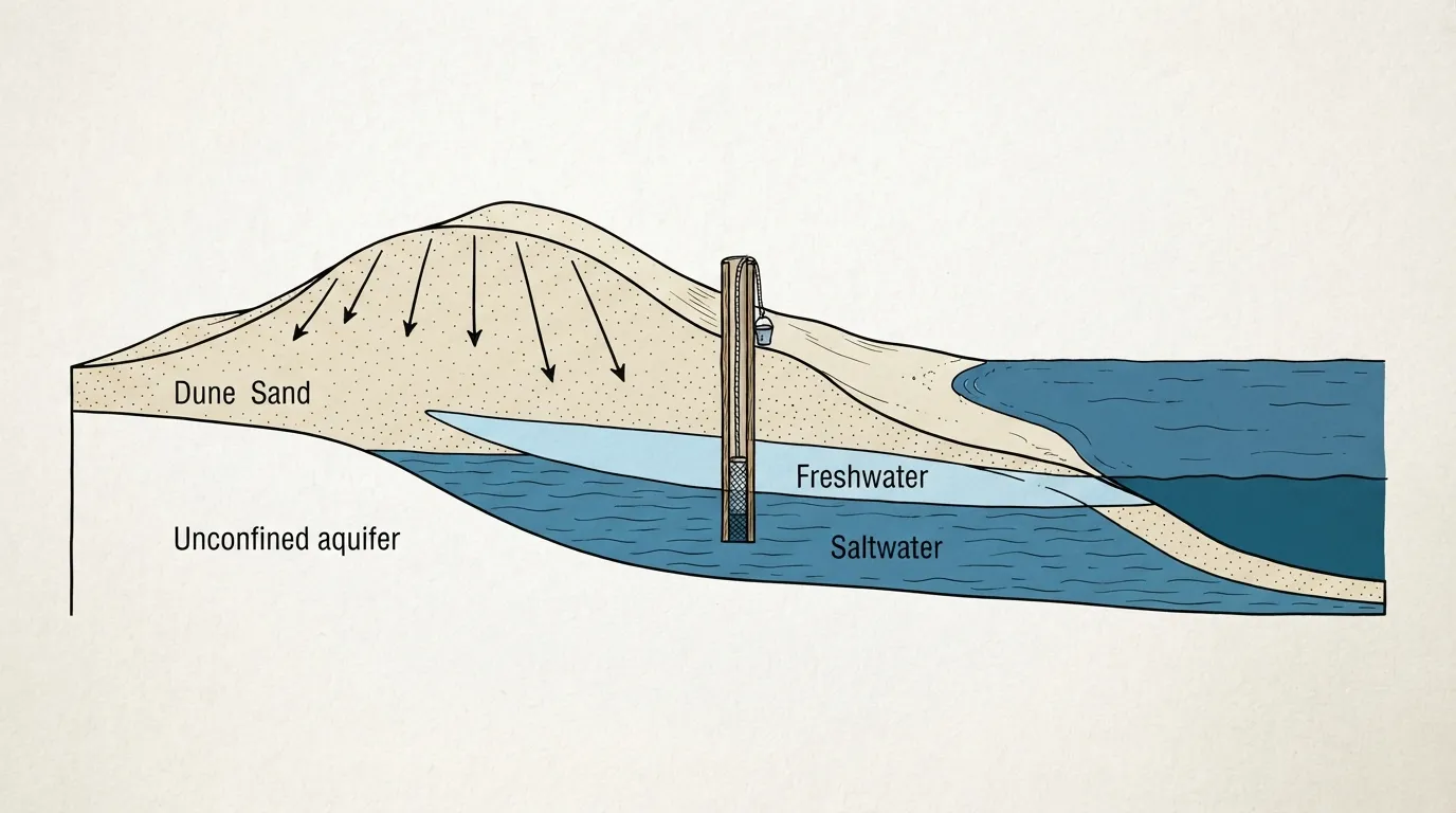
Two other less-obvious freshwater sources:
- Cliff seepages: along coastlines with fractured bedrock (limestone, chalk), rainwater percolating through inland soil leaks out along cliff faces or bases, revealed by patches of bright green moss or lush vegetation mid-cliff.
- Nocturnal condensation: securing a clear plastic sheet over damp beach vegetation or placing a smooth, flat stone out on the open sand yields dew before dawn — only a few sips, but entirely pure.
Finally, an improvised solar still (a hole with a collection container in the center, covered by plastic sheeting that condenses evaporated seawater into freshwater droplets) is a backup option rather than a primary solution: military-issue emergency stills used by WWII aviators produced 1.4 to 2.4 liters per day, but crude hand-dug survival stills frequently yield a paltry 100–150 mL per day — well below daily fluid requirements, meaning the sweat expended digging the hole often costs more water than the still returns.
Making fire on the sand
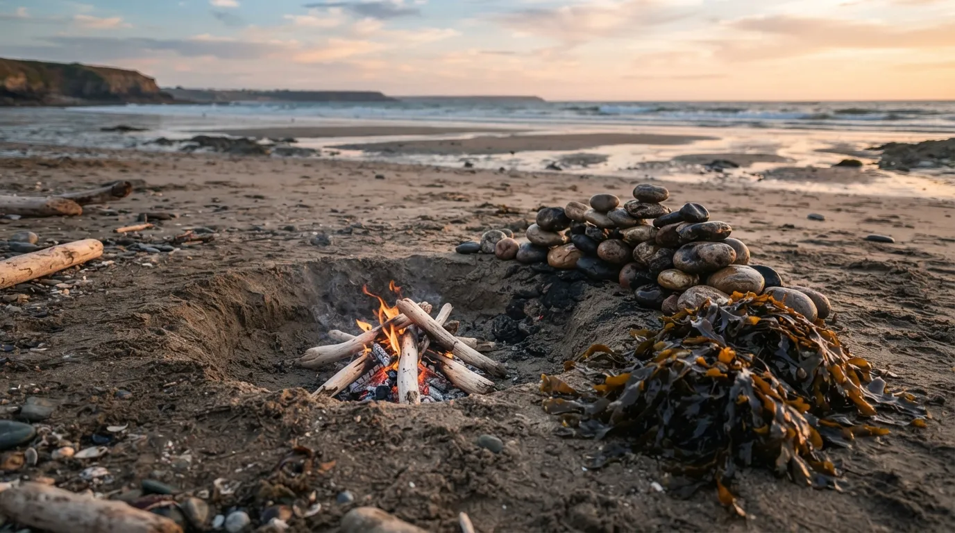
Driftwood litters almost every coastline and burns well once dry, but it carries sea salt absorbed over months at sea. When burned, sodium colors the flame a bright, characteristic yellow-orange — the exact flame test reaction chemists use to detect sodium, so dominant that it masks almost all other light spectra. The downside: that same salt, combined with synthetic paints or chemical preservatives (common on pallet scraps and construction debris), can off-gas toxic chlorine compounds when burned. Inuit communities living north of the tree line, relying heavily on river-driven arctic driftwood, developed up to seven distinct classifications of driftwood based on origin, wood type, and density — proof that sorting beach wood is a developed skill, not an afterthought.
- Dig a pit about 40 cm deep in dry sand well above the wrack line. Build a hot driftwood fire in the pit and pile smooth, non-porous beach stones on top until they’re piping hot.
- Rake out the burning embers, leaving the red-hot rocks sitting in the bottom of the pit.
- Cover the hot rocks with a thick layer of fresh, damp seaweed (kelp works best): this produces dense steam and protects food from scorching.
- Pile your catch — shellfish, crabs, fish wrapped in leaves — on top of the seaweed, layering more wet seaweed over the food.
- Seal the pit with a wet canvas cloth, tarp, or layer of damp sand to trap the steam inside. Let it cook for several hours: the moist seaweed steam cooks everything to perfection without needing a single pot.
Coastal shelters: between dune and rock
The strongest temptation along a rocky coast is taking shelter inside a sea cave: a classic, dangerous mistake. A cave carved by wave action is, by definition, located within the zone reached by the sea during high tides or storms — and cliff roofs can collapse without warning, creating what geologists call a littoral sinkhole. A blowhole spouting air and spray with passing waves is a clear sign that the cave connects directly to an active underwater chamber: never explore one, and certainly never sleep inside.
Three reliable shelter options, in order of preference:
- Behind the dunes: the sheltered depression on the inland side of a dune blocks wind without any risk of tidal flooding, provided you stay behind the primary ridge, never on the exposed ocean face.
- Driftwood lean-to: large logs washed ashore can be stacked against a sand embankment or dune ridge to create an effective windbreak in minutes — the beach hands you ready-made construction timber.
- Cliff recesses, strictly above the highest visible high-water mark, and never beneath fractured rock faces showing signs of fresh rockfalls.
Signaling for help from sky and sea
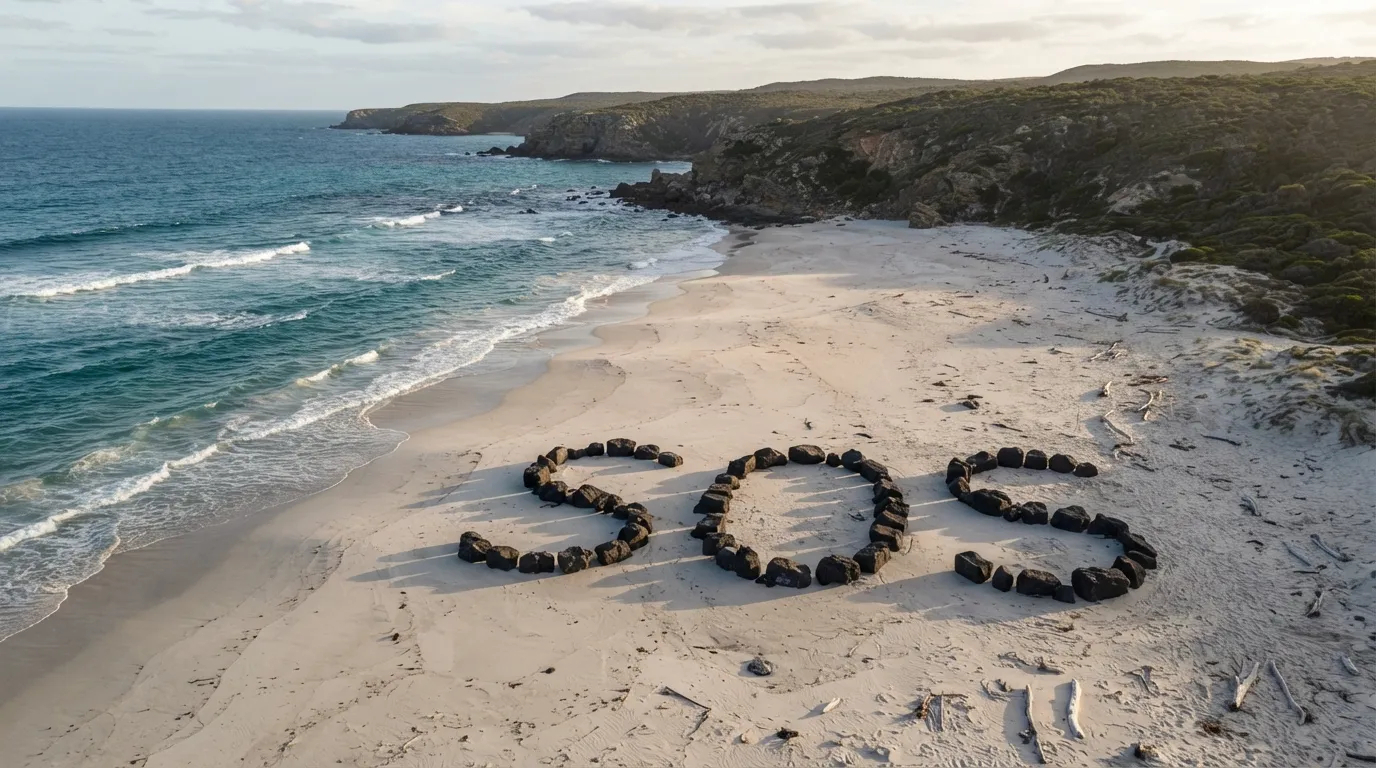
A broad beach is one of the best locations on Earth for distress signaling: flat, open, unobstructed from air and sea, and filled with materials that stand out against sand. Ground-to-air distress signals follow a universal rule: the larger, higher-contrast, and more geometric the shape, the faster it catches the eye of a pilot searching from above.
- A giant SOS: construct three letters at least 3 meters tall using dark rocks on pale sand (or dark seaweed on light sand), spaced wide enough to read clearly from 300 meters altitude.
- Contrast smoke: throwing fresh green foliage or damp seaweed onto a hot fire creates thick white smoke that stands out against dark rocks or coastal forests; dry wood alone yields faint gray smoke that vanishes easily against haze.
- Signal mirrors or reflective items (metal can lids, polished belt buckles, glass, dark smartphone screens): directing flashes toward a vessel on the horizon reaches much farther than shouting or waving, even in broad daylight.
- When aircraft are in sight, standing with both arms raised high in a “Y” shape signifies “Yes, I need assistance”; holding one arm up and one arm down (forming an “N”) means “No / negative.” This international standard requires no ground writing.
Navigating the shoreline safely
Moving along a coast presents three hazards rarely encountered together elsewhere: tides cutting off headlands you thought were passable, the temptation to climb sheer cliff faces to save time, and wide tidal flats that create a false sense of safety while deep channels cut off your retreat behind you. The golden rule to avoid all three: never follow a beach path under cliffs or across tidal flats without checking the tide schedule, and always detour around headlands via inland trails rather than risking the cliff base, no matter how much longer the detour seems. A fall from a cliff is fatal; a twenty-minute detour isn’t.
Mangroves and estuaries: where coast meets marsh
Where rivers spill into the ocean, or along tropical shorelines guarded by tangled stilt roots, standard coastal rules no longer apply. An estuary blends fresh water and salt water in proportions that shift continuously with the tide — from near-fresh upstream to roughly 3.4% salinity at the mouth. Estuaries represent some of the most biologically productive habitats on Earth: roughly 68% of commercial fish species worldwide rely on estuaries for at least part of their life cycle.
Mangroves, meanwhile, are forests adapted to saltwater immersion: these trees filter out up to 95% of salt from seawater through their roots. Their dense prop roots and aerial pneumatophores (respiratory tubes sticking up out of the mud) reveal soft, anaerobic mud underneath that is treacherous to cross on foot. Traversing and foraging in mangrove mudflats and tidal creeks fall into a distinct ecosystem category altogether: the marsh, covered separately on this site.
Beachcombing for wreckage and supplies
What the sea washes ashore isn’t random debris: ropes, netting, plastic containers, and structural timber accumulate on beaches exposed to prevailing winds and currents. Beachcombing is as old as seafaring itself. In the 19th century across the Pacific, an estimated 2,000 beachcombers — deserting sailors, castaways, and traders — lived along Polynesian and Micronesian shores, many integrating into local communities through marriage. In British Columbia, recovering lost timber logs along coastlines developed into a regulated maritime trade operating since the 1880s.
A recent wash-up can supply heavy rope, workable sheet metal, sturdy containers for holding water, or pre-cut lumber — items that would take days to craft by hand. Apply the same caution as with driftwood: closed drums may harbor hazardous chemicals, and rusted metal edges inflict deep cuts easily.
Frequently asked questions
How much time do I have before the tide cuts off my return path?
It depends entirely on local tidal range and the daily tide cycle. On flat tidal flats with large tidal ranges (like Mont-Saint-Michel Bay), rising water sweeps across miles of sand in just a few hours, accelerating dramatically during the 3rd and 4th hours after low tide (the rule of twelfths). The safest indicator isn’t a timer on your watch; it’s the wrack line: if you’re standing between the wrack line and the water on a rising tide, head back immediately.
Can you drink seawater in an emergency?
No, never. Seawater is roughly four times saltier than human blood. Drinking it forces your kidneys to pull fresh water from your body’s existing reserves to flush out the excess salt, drastically accelerating dehydration rather than slowing it down.
How do I spot a baïne or rip current from the beach before swimming?
Look for a strip of calm, darker, or discolored water cutting through the surf zone where waves aren’t breaking, often carrying foam, sediment, or debris floating out toward the open sea. It defies intuition: smooth, wave-less water surrounded by crashing waves is the classic signature of a strong offshore rip current.
Is every type of seaweed on the beach safe to eat?
In temperate waters, there are no inherently poisonous seaweeds. The primary risk stems from environmental pollution in the water where the plant grew, not the plant species itself. Skip harvesting near industrial pipes, busy harbors, or discolored water blooms, and harvest living seaweed attached to rocks rather than rotting piles decaying on dry sand.
What should I do if someone else gets caught in a rip current?
Never jump straight into a rip current to swim directly out to a struggling victim: rescuers frequently become additional casualties. Immediately raise the alarm (call for lifeguards, alert others, or throw a flotation device like a buoy or log). If you must enter the water, enter well upstream of the current so you drift down into the area safely rather than fighting the current head-on.
Is burning driftwood toxic to your health?
Natural, untreated driftwood dried in the sun burns safely, though it produces slightly saltier smoke. The danger lies in painted, varnished, or chemical-pressure-treated lumber mixed in with beach debris: burning treated timber releases toxic organochlorine compounds, which are especially hazardous in enclosed shelters or around cooking fires.
Key takeaways
- The coast offers more food than almost any other environment, but operates on a strict clock you must learn to read: wrack line, tidal ranges, rule of twelfths, and lunar phases.
- The real killers along the coast don’t look dangerous: a calm rip current, quicksand that looks like firm beach, or a cliff face that has stood for centuries.
- In a baïne or rip current, never fight the water head-on: swim parallel to the shoreline until you escape the narrow pull of the current.
- Shellfish, seaweed, crabs, sea urchins, and stone tidal traps form a self-replenishing pantry twice a day — provided you avoid polluted runoff and harmful algal blooms.
- Fresh water is frequently hidden behind primary sand dunes, never in the wet sand of the tidal flat; and sea caves are dangerous places to spend the night.
Further reading
- SNSM (French National Sea Rescue Society) — safety guidelines on coastal hazards and sea rescue protocols.
- Observatoire de la Côte de Nouvelle-Aquitaine — Rip currents formation and beach hazards, detailed scientific breakdowns of coastal hydrology.
- Wikipedia — Tromelin Island, the historical account of the Utile castaways who survived fifteen years on a treeless sandbar.
- SHOM (French Naval Hydrographic and Oceanographic Service) — official tide tables and tidal dynamics data.
Sources for this module (35)
- Wikipédia — Marée (coefficient, marnage, régime semi-diurne)
- Wikipédia — Coefficient de marée et règle des douzièmes
- Wikipédia — Baïne
- Wikipedia (EN) — Rip current
- Wikipedia (EN) — Undertow (water waves)
- Wikipédia — Sable mouvant
- Wikipédia — Recul du trait de côte (érosion des falaises en France)
- Wikipedia (EN) — Rogue wave
- Wikipedia (EN) — Sneaker wave
- Wikipedia (EN) — Cold shock response
- Wikipedia (EN) — Wrack line / Beach wrack (laisse de mer)
- Wikipedia (EN) — Freshwater lens
- Wikipedia (EN) — Solar still
- Wikipedia (EN) — Paralytic shellfish poisoning
- Wikipedia (EN) — Oyster (règle des mois en R)
- Wikipedia (EN) — Flame test (le sel qui colore la flamme)
- Wikipedia (EN) — Clambake
- Wikipedia (EN) — Driftwood
- Wikipedia (EN) — Fish trap (pièges à poissons de marée)
- Wikipedia (EN) — Sea cave (grottes marines, littoral sinkhole)
- Wikipedia (EN) — Tide pool
- Wikipedia (EN) — Mangrove
- Wikipedia (EN) — Estuary
- Wikipedia (EN) — Beachcombing
- Wikipedia (EN) — Distress signal (signaux sol-air, Y/N)
- Wikipedia (EN) — Littorina littorea (bigorneau)
- Wikipedia (EN) — Mytilus edulis (moule commune)
- Wikipedia (EN) — Palmaria palmata (dulse)
- Wikipédia — Laitue de mer (Ulva lactuca)
- Wikipedia (EN) — Kelp (kombu)
- Wikipedia (EN) — Sea urchin
- Wikipedia (EN) — Alexander Selkirk
- Wikipedia (EN) — Pedro Serrano (sailor)
- Wikipédia — Île Tromelin (naufragés de l'Utile, 1761)
- Wikipedia (EN) — Ada Blackjack
Continue in "By environment"
The temperate forest
The most generous environment in the world can also swallow you in ten minutes: here is how to read it instead of fearing it.
Mountains: Where the Weather Decides for You
The weather changes in thirty minutes, altitude works against you, the terrain is unforgiving: the signs to read before it's too late.
Snow, extreme cold, and the Far North: surviving at minus 30
Cold doesn't kill you: humidity, exhaustion, and panic do. What you need to know to stay alive below zero.